If you’re tired of watching snow fall and are itching for a change of scenery—and Hawaii is not in your budget just now—then load up your snowshoes or fat bike and head to a (mostly) secret spot in southeastern Idaho. City of Rocks, a mini-Moab just three hours south of Boise near the Utah border, offers a splendid array of year-round recreational opportunities and breathtaking landscapes.
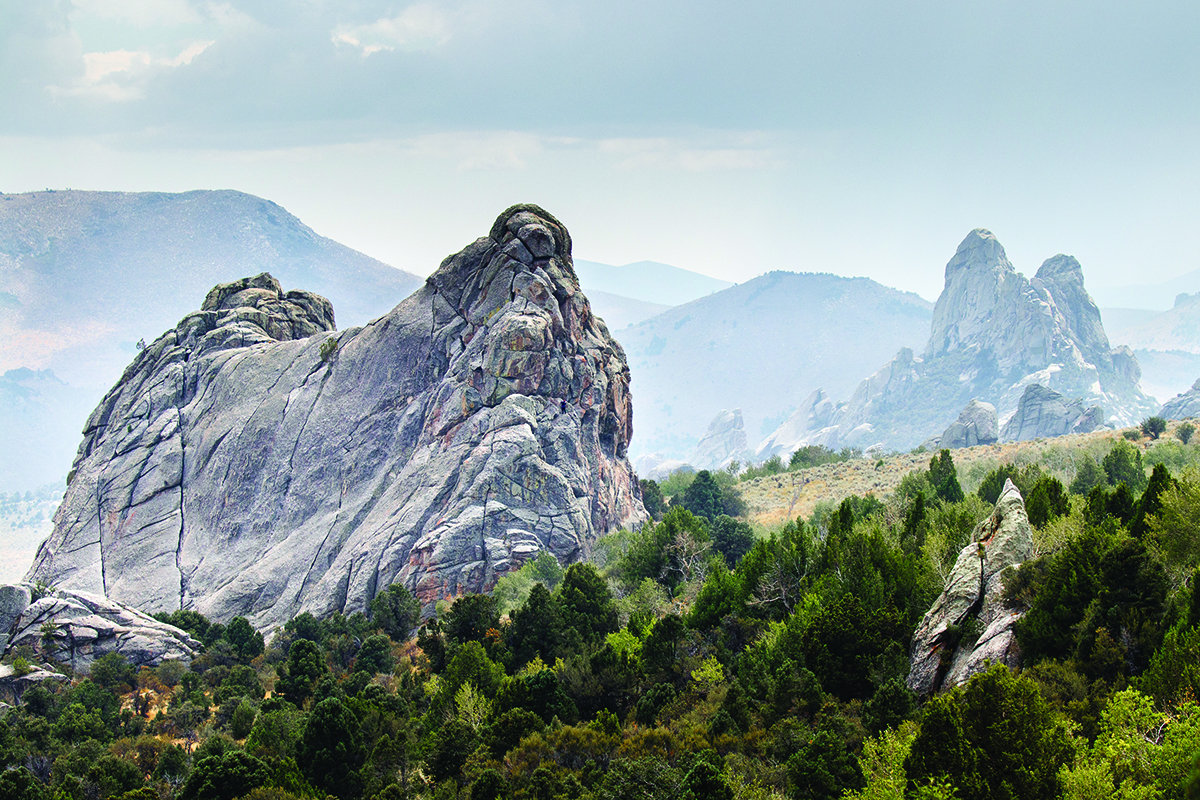
More than 22 miles of trails wind through a “city” of spectacular granite spires that rise as high as 600 feet. You can admire these geologic formations from your snowshoes, cross-country skis or fat bike during the winter months. Summer, of course, is the busiest season with horseback riding, hiking and birdwatching of more than 150 documented species. But winter in the City of Rocks has a beauty all its own, and you can spend the entire day in splendid isolation.
The City, as it’s known among those who frequent its boundaries, is best known for its hiking and climbing. The City offers some of the best granite-face climbing sites in the West. There are about 700 climbing routes that have been developed. According to an old guidebook, a young girl named Jean Nicholson, who moved to the nearby Circle Creek Ranch in 1938, “was the first person of record to climb many of the major formations in the City.”
Most of the “newer” granite spires were formed as part of the 28-million-year-old Almo pluton—a body of igneous rock crystallized from magma slowly cooling beneath the surface of the earth. Other spires are part of the 2.5-billion-year-old Green Creek Complex, some of the oldest exposed rock on earth. The rock formations developed through a process called exfoliation—a kind of facial for Mother Earth—in which thin rock plates collapsed along the fractures of the rock. The fractures were a result of the granite contracting as it cooled from the magma, then thrust upward.
Hiking trails range from easy short loops to difficult steep peaks. The Window Arch Trail, is a mere 300 feet long and leads to a rock formation arch which spans 20 feet and is similar to Arches National Monument near Moab. From Window Arch, you get wonderful views of the “Inner City” as well as other windows, bathtubs and caves formed by the forces of erosion. Another easy trail loops the 240-foot high Bath Rock, so named for the panholes or natural pools that formed on the flat surface of its top. The panholes are filled with rainwater or snowmelt.
The more strenuous 5-mile North Fork Circle Creek Trail takes you deep into the City as you follow the creek from sagebrush flats to aspen groves. The trail leads to the Horizons Arch of the Shangri La formation, the largest arch in the reserve. Hiking along the moderately difficult Indian Grove Trail gives you an unobstructed view of Graham Peak, the highest point in the reserve at 8,867 feet. City legend holds that the Shoshone and Bannock Indians who lived among the spires and meadows stood silently in the trail’s grove of aspen and fir and observed the pioneers as they trudged along the California Trail, headed west to the riches of the goldfields.
One of those early emigrants, James Wilkins, was one of the first wagon travelers to cross the Almo Valley on what became the California Trail. In 1849, he wrote, “We encamped at the City of the Rocks, a noted place from the granite rocks rising abruptly out of the ground. They are in a romantic valley clustered together, which gives them the appearance of a city.”
Emigrants bound for California and Oregon traveled along the Oregon Trail until crossing the Raft River, where the trail split. California-bound travelers headed southwest along the Raft River to Cassia Creek and the Jim Sage Mountains, moving through the Elba Valley to Almo Valley. Today you can still see the signatures of some of those hardy souls scrawled in axle grease across the rock faces. The trail roughly follows the course of State Route 77 Spur of the city of Rocks Scenic Byway.
The City of Rocks was designated a national preserve in 1988 and today is managed jointly by the National Park Service and the Idaho Department of Parks and Recreation.
The best way to enter the City of Rocks is through the small gateway town of Almo, where locals claim, “The Pavement Ends and the West Begins.” All of the other roads into the City are dirt roads between 20 and 70 miles long. The reserve is open year-round, but some roads may be impassable during the winter. A Visitor’s Center in Almo is open seven days a week in summer and Tuesday through Saturday in the winter. Limited lodging and dining is available in Almo, and in the City itself. Round out a day in the City with a lovely soak in Durfee Hot Springs, just outside Almo.