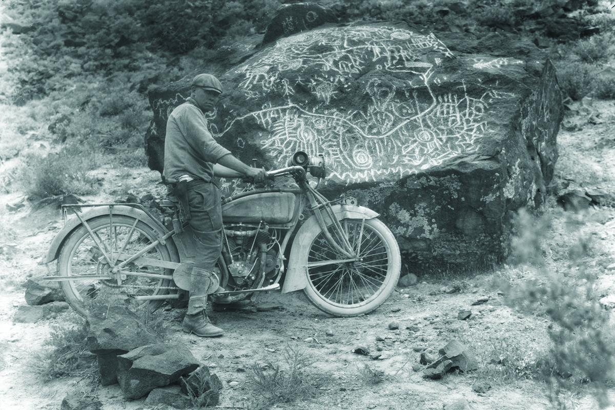
What could be the oldest map in the world is right here in Idaho: Map Rock, located in Canyon County, between Nampa and Melba.
Created on a large basalt boulder, it is covered with petroglyphs, or pictures made by pecking them into the surface of the rock. That’s as opposed to pictographs, which are pictures painted on to a rock.
Thought to have been created by local Shoshone Paiute tribes, it was first discovered by white settlers in the late 1870s, according to Dr. Mark Plew, Director for the Center for Applied Archaeological Science in the Department of Anthropology at Boise State University.
But it wasn’t named Map Rock until Robert Limbert, a naturalist for the Smithsonian, moved out here in 1911 and gave it that name in the 1920s, Plew said. “He’s the one who really put it on the map.” It was listed on the National Register of Historic Places in 1982.
It might surprise you, but Map Rock has no signs, fences, or barriers. That’s because the Canyon County Parks Department, which acquired the property and 34 surrounding acres in 2012 in a land swap, wants to respect its cultural heritage, said Nicki Schwend, director of Canyon County Parks, Cultural and Natural Resources, in Nampa. “Our biggest concern is protecting that cultural heritage,” she said. “Our big concern is that they’re so close to the road that they need protection from vandalism. We can’t put a fence around it, because it changes the cultural landscape.” Similarly, the park can’t move Map Rock to a more protected area, because that also changes the cultural landscape. “That is one of the worst things we could do.”
Schwend is working with the local tribes to get more information about their interpretation of Map Rock, which could then be housed at nearby Celebration Park, Idaho’s only archeological park, which also has petroglyphs. “We’re not interested in putting signage right at the rocks, because that puts a bulls-eye on it,” she said.
Nobody’s quite sure what Map Rock is. Limbert was the one who named it Map Rock, and described it in detail in a 1922 Idaho Statesman article. Don Zuhlke, author of “The Map Rock of Idaho Decoded,” spent 20 years researching the rock, identifying landmarks along nearby rivers, and then demonstrating how they lined up with Google Earth. But is it really a map?
“Interpretations range from doodling to resource marking,” Plew said.
For its part, the Canyon County Parks Department demurs from calling it a map, said Schwend. “It was a European who was the first and only person who called it a map,” she said, adding that the parks department is working with local tribes to learn more. “That’s the information we’re trying to get them to share with us, but sharing has not always benefited Native Americans that well,” she admitted. “They might have religious associations with that area they might not want to disclose.” And it may have had another purpose, such as shamanistic activity or rituals.
Nobody knows how old Map Rock is, either. In “To the Ends of the Earth: 100 Maps That Changed the World,” by Jeremy Hardwood and A. Sarah Bendall, Map Rock dates to 10,000 B.C. That would make it the oldest known map in the world, according to Dr. Karen Pinto, assistant professor of Middle Eastern and Islamic History in the Department of History at Boise State University.
On the other hand, Plew said, the majority of rock art in the area dates to the past 1,500 to 2,000 years. But dating petroglyphs is challenging, Schwend said. “It’s not like a tree—you can’t do radiocarbon dates,” she said. “The best you can do is compare it with other petroglyphs and compare the patination,” or oxidation of the minerals on the surface.
It all boils down to the question of “What is a map?” Deciphering pre-modern pieces is all about interpretation, Pinto said. “To open up to seeing it as a map, you have to understand that in the prehistoric period—even today—there are all sorts of things about whether they’re maps,” she said. “The definition of ‘map’ is quite open.”
Visiting Map Rock
Want to check out Map Rock for yourself? Here are directions from the Canyon County Parks Department:
From Nampa, travel south on Highway 45. Turn right on Map Rock Road. Travel 7.3 miles to Map Rock, located on the right side of the road. It is open until dusk, year around.
The nearby Wees Bar region is also home to scores of other petroglyphs, and there’s a 12-mile trail to it from Swan Falls Dam.
While you’re in the area, check out Celebration Park, Idaho’s only archeological park, which features other petroglyphs, as well as tours and other information.