When the snow finally melts and the temperatures warm after a long winter, the Boise foothills welcome eager hikers, runners, and mountain bikers ready to enjoy the trails again in the spring.
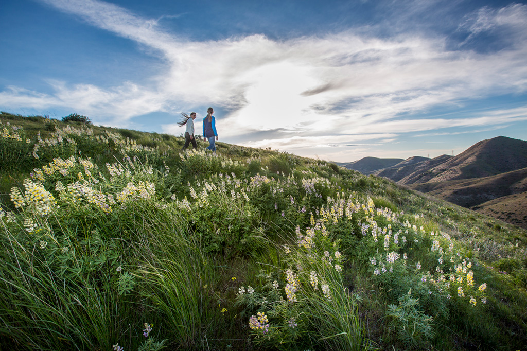
The spring is also a special time when the foothills transform, briefly trading in their typical muted shades of brown and yellow for a dark green backdrop punctuated with bright white, yellow, and purple wildflowers. Because of that, it might not be surprising to learn that spring is the busiest time of year for the foothills.
“Spring is really busy in the foothills, but it’s also the prettiest time in the foothills,” said David Gordon, Ridge to Rivers trail system manager. “It’s just beautiful.” Gordon said trail usage begins to pick up starting about mid-March.
There are more than 190 miles of trails to explore in the trail system, according to Ridge to Rivers, but there are a couple of areas in particular that Gordon recommends for taking in the wildflowers on a spring hike or run.
Military Reserve
Central Ridge Trail
The flowers start to bloom at the Military Reserve area of the foothills typically in early to mid-spring, Gordon said. He recommends the Military Reserve’s Central Ridge Trail that time of year. The trail offers spectacular year-round views of downtown Boise, but in the spring, those views are framed by wildflowers, making a spring hike even more special.
The Military Reserve is easy to access with plenty of parking. To get there from Avenue B near St. Luke’s Hospital in downtown Boise, take Reserve Street to Mountain Cove Road. There a few different options for designated parking areas on Mountain Cove Road, and numerous options for making loops on the trails from those parking areas, whether you want to do just a couple of miles or a long trail run or hike.
One option is to park at the Toll Road Trailhead. This is past the archery range and just around the curve on Mountain Cove Road. From the parking area, take Toll Road Trail up to Ridge Crest Trail. Climbing Ridge Crest, one enjoys fun switchbacks that turn a beautiful shade of green with spring wildflowers on either side of the trail.
The top of Ridge Crest joins Central Ridge. Go left on Central Ridge for a shorter loop. Follow Central Ridge back down to Toll Road and the parking area. Going down Central Ridge allows runners and hikers to take in the views of the city and wildflowers at the same time. That’s about two miles.
For a longer loop, go right at the top of Ridge Crest on Central Ridge and come back down Bucktail Trail. Turn left on Ridge Crest to get back over to Central Ridge and the parking area.
Yet another option is to add Shane’s Trail and Three Bears Trail from Central Ridge for a longer loop and more hills, then come back down Bucktail to Central Ridge, which will be about seven miles total.
Later in the spring, Gordon recommends the Watchman Trail for wildflowers. This three-mile trail connects to Five Mile Trail, which has a trailhead and parking on Shaw Mountain Road and the upper end of the Three Bears Trail.
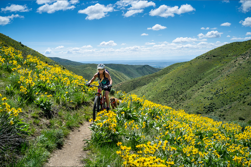
The Watchman Trail winds through yellow arrowleaf balsamroot wildflowers in late spring. Photo by Glenn Oakley
Spring Trail Conditions
One of the key messages Ridge to Rivers officials try to convey to people throughout the year is to pay attention to trail conditions and to stay off muddy trails. This can be an issue in the spring with rainy weather and melting snow.
Using the trails when they’re muddy can widen them and cause erosion, Gordon said. Footprints on a muddy trail can make the surface look like a tractor tilled it up, he added.
The Ridge to Rivers website and Facebook page have up-to-date trail conditions each day to help people plan ahead. It includes information on specific trails to avoid and what to expect.
When conditions are marginal, Gordon suggests using sandier trails or doing an out-and-back hike or run instead of trying to make a loop. One suggestion is a five-mile out-and-back starting in Boise’s Camel’s Back Park, which is at the corner of 13th and Huron streets. Start on Red Fox Trail and follow that to get to Lower Hulls Gulch Trail. Turn around at the top and come back, instead of trying to make a loop with other trails. There’s a creek along Lower Hulls Gulch Trail that’s flowing in the spring. The sights and sounds of the flowing water add to the beauty of the trail, which also has some trees alongside it and a fun rock formation to hike over.
According to Ridge to Rivers, this is one of the most popular trails in the system.